
Our Technology
At Terraprobe, we leverage advanced GPR technology to provide unparalleled precision in subsurface investigations. Our state-of-the-art Ground Penetrating Radar (GPR) systems enable accurate detection of underground utilities, concrete structures, and hidden anomalies, ensuring efficient project planning and safety. By utilizing the latest GPR technology, we offer fast, cost-effective, and non-destructive solutions, setting the standard for quality and reliability in subsurface exploration.
Concrete Scanning
GSSI Sir 4000
The SIR 4000 Radar system is a high-performance GPR data acquisition with 2Ghz antenna. It operates with both analog and digital antennas, making it versatile and flexible.
Uses:
Benefits:
- Accurate and reliable results with efficient data collection and visualization.
- Great for all working conditions from rain to dusty environments
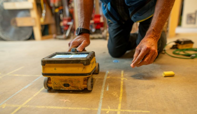
IDS C-thrue
The C-Thrue is an easy-to-use and robust solution to see through concrete structures and reveal true data.
Uses:
- Concrete Scanning
Benefits:
- Detects deeper and shallower targets for increased accuracy
- Clearer and faster surveys in one scan
- Easily transportable, offering flexibility for all job sites, particularly constricted and hard-to-reach spaces.
- Maximum data accuracy
Utility Locating
 antennas oriented in 2 polarizations.")
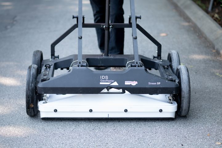
IDS Stream-C
Stream C Ground Penetrating Radar (GPR) detects underground utilities in real time and quickly produces subsurface GIS-based digital maps. Due to the system’s flexibility and size, Stream C can be used in urban environments and for a wide range of applications, from pipe mapping, civil engineering, archaeology to tunnel and bridge detection.
Uses:
- Utility Locate
- Void Detection
- Subsurface Survey/ Geotechnical
- Burial Sites
Benefits:
- High Productivity: Surveys only need to be performed in one direction to ensure optimal detection of both longitudinal and transversal pipes.
- Facilitates large surveys: The system can be towed manually or with a small vehicle, increasing the acquisition speed (up to 6 km/h).
- Quick results with Automatic Pipe Detection and Real-time tomography on a GPS or total station assisted cartographic background.
GSSI Sir 4000 with 400Mhz Ant
The SIR 4000 Radar system is a high-performance GPR data acquisition with 2Ghz antenna. It operates with both analog and digital antennas, making it versatile and flexible.
Uses:
- Utility Locate
- Void Detection
- Subsurface Survey/Geotechnical
- Burial Sites
Benefits:
- Accurate and reliable results with efficient data collection and visualization.
- Great for all working conditions from rain to dusty environments

IDS 4Lite
Radar system with dual 200 and 600 Mhz antenna
Uses:
- Utility Locate
- Void Detection
- Subsurface Survey/Geotechnical
- Burial Sites
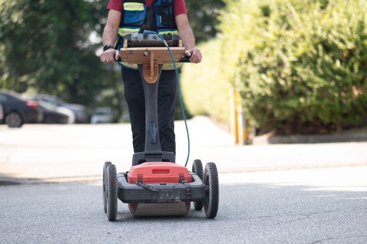
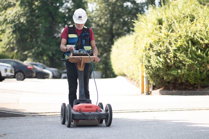
IDS Stream-DP
The Stream C's updated version. Being smaller in size and better suited to rougher terrain, the Stream-DP has improved flexibility to cover the needs of any job. It can be pulled behind a vehicle at 14k/hr, making detection even quicker.
Uses:
- Utility Locate
- Void Detection
- Subsurface Survey/Geotechnical
- Burial Sites
Benefits:
- High Productivity: Surveys only need to be performed in one direction to ensure optimal detection of both longitudinal and transversal pipes.
- Facilitates large surveys: The system can be towed manually or with a small vehicle, increasing the acquisition speed (up to 14 km/h).
- Quick results with Automatic Pipe Detection and Real-time tomography on a GPS or total station assisted cartographic background.
- Good for rough terrain and smaller spaces