Pavement Assessment
Pavement Assessment Services in British Columbia
Supporting Infrastructure Longevity Through Data-Driven Analysis
At Terraprobe, we provide comprehensive pavement assessment services across British Columbia, supporting municipalities, engineering consultants, and infrastructure stakeholders with reliable, data-backed insights that inform rehabilitation strategies, budget forecasts, and lifecycle planning. With rising demands on public infrastructure and growing pressure to optimize capital expenditures, our pavement evaluations serve as a strategic foundation for long-term asset management.
CALL FOR FASTER SERVICE 604-553-4778

Why Pavement Assessments Matter
Smart Infrastructure Starts Below the Surface
Pavement condition is a critical component of urban infrastructure management. Whether managing arterial roadways, collector streets, or airport tarmacs, understanding the structural and surface-level integrity of pavements enables decision-makers to:
1. Extend Pavement Lifespan
Target interventions based on accurate structural data.
2. Optimize Infrastructure Budgets
Support data-backed capital planning and cost forecasting.
3. Enable Strategic Asset Management
Feed decision-ready insights into your existing systems.
What’s Included in a Terraprobe Pavement Assessment?
Surface distress analysis (cracking, potholes, ravelling, etc.)
-
Structural strength testing using FWD
-
Ride quality and IRI measurement
-
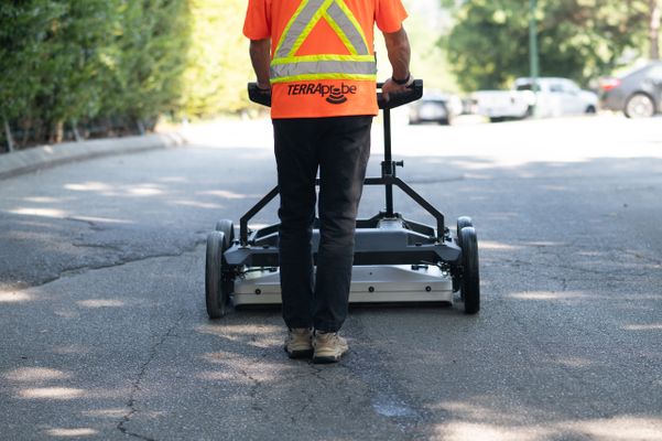
Pavement thickness scans with GPR
-
GIS-based mapping and inventory
-
Lifecycle condition reporting and PCI ratings
Surface to Subsurface: Comprehensive Condition Evaluation
Surface Distress Mapping
Identify all cracking, deformation, and failures using LCMS and digital imaging.
Structural Integrity Testing
Non-destructive FWD testing for load-bearing evaluation and overlay design.
Subsurface & Layer Analysis
GPR data used to analyze asphalt thickness and base material conditions.
Serving British Columbia's Infrastructure Stakeholders
Municipal Governments (e.g. City of Vancouver, New Westminster, Burnaby)
-
Transportation Departments
-
Airport Authorities
-
Engineering and Planning Consultants
-
Campus and Facilities Managers
-
Developers Requiring Pre-Construction Baselines
What Sets Terraprobe Apart?
Local Expertise in BC Conditions
Our team understands the unique challenges of British Columbia’s climate, soil composition, and construction standards. This means more accurate assessments, realistic forecasts, and treatment recommendations that work in our environment.
Certified Testing and Professional Engineering Oversight
Our work complies with ASTM D6433, AASHTO, and municipal procurement requirements. Licensed Professional Engineers (P.Eng) oversee all assessment outputs and provide sealed documentation for regulatory compliance.
Lifecycle and Financial Planning Support
Beyond condition assessment, Terraprobe provides risk-based maintenance modeling, lifecycle cost analysis, and capital forecasting—so you can optimize funding strategies and defend infrastructure investments.
Let’s Build a Smarter Road Network, Together
Tell us about your road network or infrastructure project, and we’ll tailor a pavement assessment plan to meet your goals.
See the Difference Data Makes
Download a sample report
FAQ
⟶ Flexible Pricing Options
⟶ Performance Warranty
⟶ Local Marking & Reports Available
⟶ Large Equipment Inventory

